

Shee of Ardtalnaig [Ciste Buide a' Claidheimh]
Good walks are even better shared.
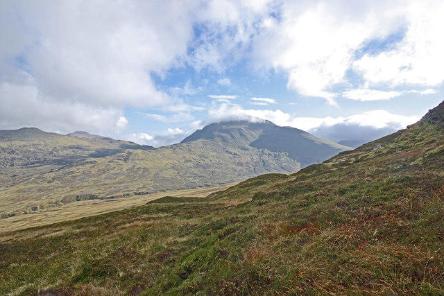
NN7235 : Summit of Shee of Ardtalnaig
Andrew Spenceley Photo source
Overview
Shee of Ardtalnaig [Ciste Buide a' Claidheimh]
Situated in the scenic Scottish Highlands, Shee of Ardtalnaig, reaching 755 meters, is a Marilyn that beckons outdoor enthusiasts and hill-walkers alike. With an elevation offering a sturdy prominence of 172 meters, it stands as a proud landmark amidst a backdrop of rugged beauty.
Geology
Formed from resilient schist and granite, the Shee of Ardtalnaig showcases the characteristic features of the Highlands' geology. Expect to encounter fascinating rock formations and sturdy outcrops as you ascend, adding a bit of variety to your climb. Hugging the contours of the mountain, these rocks whisper tales of ancient geological processes.
Routes
The main route begins at the parking area near Ardtalnaig. This scenic path (about 6 km long) weaves through heather-clad hills and grassland, unveiling lovely panoramas with each step. It takes approximately 2.5 hours to reach the summit and is graded as moderate—perfect for those with a bit of hillwalking experience.
Summit Features
As you reach the summit, a large stone cairn greets you—perfect for a photo op! The vantage point offers breathtaking views of Loch Tay and beyond, making your efforts worthwhile. Lug your sandwiches up for a summit picnic; after all, you’ve earned it!
Terrain Type
The terrain consists mainly of grassy slopes, interspersed with rocky sections as you approach the top. Don’t be surprised if you find yourself dodging a few nimble sheep along the way—they're the mountain's unofficial guides!
Views
From Shee of Ardtalnaig, the views are nothing short of stunning. Look out for Ben Lawers standing to the north, along with the serene beauty of Loch Tay to the south. Spring and autumn provide the best visibility, with clear skies amplifying the impressive sight.
Hazards
While enjoying your adventure, keep an eye on the ever-changing weather conditions common in this part of Scotland. Loose rocks can also make for a rollicking adventure if you’re not careful. And while the wildlife is charming, remember to stay respectful, particularly during lambing season!
Nearby Summits
If you're up for more adventure, nearby peaks like Ben Lawers and Meall nan Tarmachan offer additional climbing opportunities. Why not make a day of it?
Access
Accessing Shee of Ardtalnaig is straightforward. The Ardtalnaig car park provides a good place to leave your vehicle, which is approximately 10 km from Aberfeldy—your nearest town where you can find refreshments and facilities.
Facilities
Whether you fancy a caffeine fix before your trek or a toilet stop on your return, Aberfeldy has it all. Make sure to check out the quaint cafes around!
History
The name 'Shee' relates to Gaelic folklore, adding a sprinkle of magic to your hike. This mountain isn't merely a geographical feature; it carries historical and cultural significance linked to the local clans and their stories.
Put on your walking boots and get ready to embrace the scenic wonder that is the Shee of Ardtalnaig! Remember, it's not just about the destination, but also the delightful journey along the way.
Explore routes near Shee of Ardtalnaig [Ciste Buide a' Claidheimh]
Walks starting near this hill. Open a route to check its map, distance and full itinerary.
Kenmore: Drummond Hill Black Rock Trail above Loch Tay
View route
Killin: Falls of Dochart, Finlarig and Moirlanich Longhouse
View route
Crieff: Lady Mary's Walk and the River Earn
View route
Aberfeldy: Glassie Woodland and River Tay Circular
View route
Route planning notes
These notes describe possible approaches. Check a route's map and access information when planning your walk.
Ardtalnaig to Shee of Ardtalnaig
A scenic ascent following well-defined paths through heather and grassland, leading directly to the summit.
Make a day of it, together
Find someone to share the walk with, or organise a day out along a route you like.
Photo Gallery
View all Photo could not load
NN7235 : Summit of Shee of Ardtalnaig
Andrew Spenceley
 Photo could not load
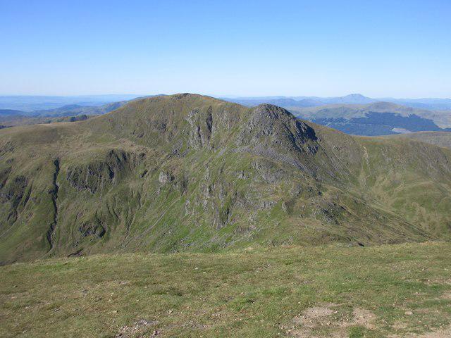
NN7235 : Summit cairn, Ciste Buide a' Claidheimh
Alan O'Dowd
 Photo could not load
NN7235 : Ciste Buide a' Claidheimh (summit cairn)
Raibeart MacAoidh
Hill facts and local notes
Classifications
Elevation
758m
2,488 ft
Prominence
226m
Coordinates
56.4915, -4.0650
NN729351
OS Map
51 52
Explorer: OL48E 378E
At the Summit
The summit is marked by a large stone cairn and offers a sweeping view of the surrounding landscape, including Loch Tay to the south.
Terrain & Geology
Shee of Ardtalnaig is primarily composed of schist and granite, characteristic of the mountainous regions of the Scottish Highlands, providing robust slopes and some fascinating rock formations.
Views & Scenery
From the summit, hikers can enjoy spectacular views of Loch Tay, Ben Lawers, and the southern Highlands. On a clear day, the sight of distant mountains stretching out is truly breathtaking.
History & Heritage
Name Origin
The name 'Shee' is derived from the Gaelic word 'Sithech', meaning fairy, giving the mountain a mystical connotation.
Historical Significance
The area has historical associations with ancient clans and has been a part of local lore and culture throughout centuries.
Getting There & Facilities
Parking
Parking is available at the Ardtalnaig car park (NN721317), which usually accommodates around 15 vehicles.
Public Transport
Regular buses run from Aberfeldy to the vicinity, although timings may vary, so it's best to check the local timetable.
Nearby Facilities
Aberfeldy has a range of facilities including cafes, shops, and public toilets. A perfect spot for pre-adventure coffee!
Safety Information
Known Hazards
- Potential for sudden weather changes, loose rocks in high winds, and boggy patches in lower areas.
- Always be cautious of wildlife, particularly during lambing season.
General Safety Tips
- Check weather conditions before setting out
- Carry appropriate clothing and equipment
- Let someone know your planned route
- Take a map, compass, and GPS device
- Carry emergency supplies: food, water, first aid kit, torch
Hills
Some common questions about the hills answered
Are there group walks up Shee of Ardtalnaig [Ciste Buide a' Claidheimh]?
Many walkers use Walkmates to join or organise walks with others. You can check for group walks around Shee of Ardtalnaig [Ciste Buide a' Claidheimh] through the maps
Are there other walkers around Shee of Ardtalnaig [Ciste Buide a' Claidheimh]?
Activity varies by location and time, but Walkmates lets you see whether others have shared walks or shown interest in this area. Find other people through the walking friends search walking friends for Shee of Ardtalnaig [Ciste Buide a' Claidheimh] search or of course create your own walk for Shee of Ardtalnaig [Ciste Buide a' Claidheimh]
Can I organise a walk to Shee of Ardtalnaig [Ciste Buide a' Claidheimh]?
Yes. If there aren’t any walks listed already, you can create a walk and make it available for others to join.
If you're signed up to Walkmates, you can create a walk to Shee of Ardtalnaig [Ciste Buide a' Claidheimh].
How do I find a walk up this hill?
There are often multiple ways to walk this hill, depending on experience and route preference. Walkmates helps you explore walks and routes that others have shared.
Can I suggest a new route up Shee of Ardtalnaig [Ciste Buide a' Claidheimh]?
Yes. You can suggest or create routes to share with others. Walkmates focuses on the social side of walking, so routes are used to help people organise walks and explore areas together, rather than as detailed navigation tools or route libraries.
Other uses really appreciate knowledgeable walkers sharing their routes. Share your favourite route to Shee of Ardtalnaig [Ciste Buide a' Claidheimh] here
The is an error or something incorrect about this hill. How do I let you know?
We always strive to keep the information on Walkmates as accurate as possible. If you find an error, please let us know through the contact form and we'll aim to correct it as quickly as possible
Community Discussion
Comments
Location
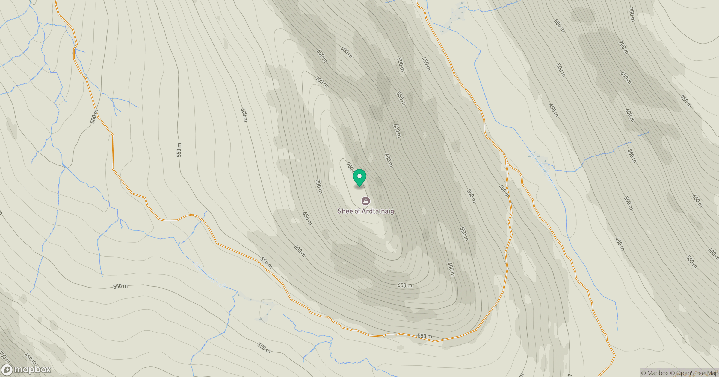
Grid reference: NN729351
View on OpenStreetMapOpens a map in a new tab, centred on the hill.
No comments yet. Be the first.